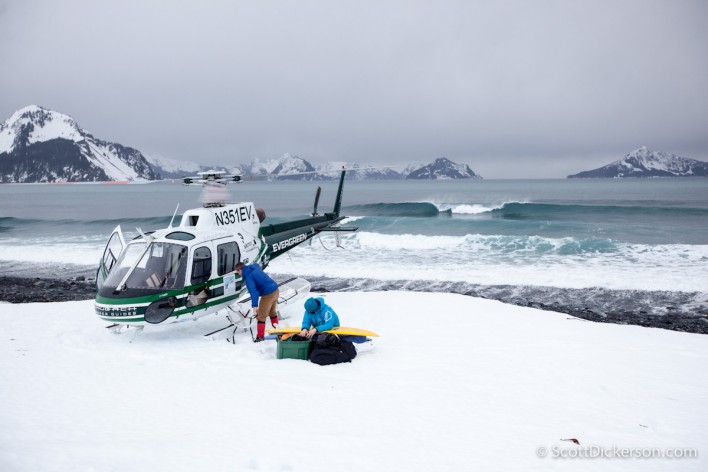
Helisurfing. There’s a word I’ve been thinking about for a while. Just sounds nice. Finally had a chance to do more than just think about it yesterday. Thanks to Jeff Hoke and the Chugach Powder Guides for making this come together. Laying in bed catching up on some sleep from our recent travels down under, Jeff called and said we might have a chance for a helisurf trip. I had been watching the swell and knew this would be good opportunity to live the dream so the scramble began.Two of hours getting boards, wetsuits, booties, mittens etc. together for everyone stuffing everything in the Suby and I was off on the 3.5hr drive over to Seward.
Tag: photo shoot
-
Aerial photos by paramotor
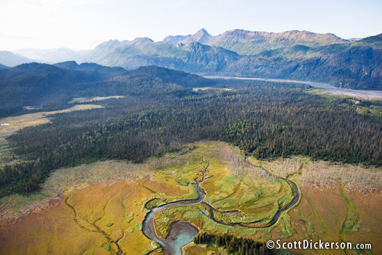
Aerial photo of Kachemak Bay State Park in Autumn. Here in Alaska the days are getting longer and the weather has been trying to improve. Spring is certainly on it’s way. With the longer days and fewer storms I’ve been able to photograph from my powered paraglider (paramotor) pretty regularly in the last couple weeks. You can read my introductory post about photography from a paramotor here.
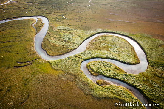
The aerial photos in this post are from an early morning flight I took last August. Leaving from the Homer Spit up and over Kachemak Bay to China Poot Bay. The wetlands in China Poot are very colorful in the autumn with interesting patterns caused by the fresh water streams and tidal sloughs. All this is backed by the sun rising over the Kenai Mountains. The crisp and still morning air was perfect for flying and photographing in.
-
Aerial and air to air photoshoot for NY Times
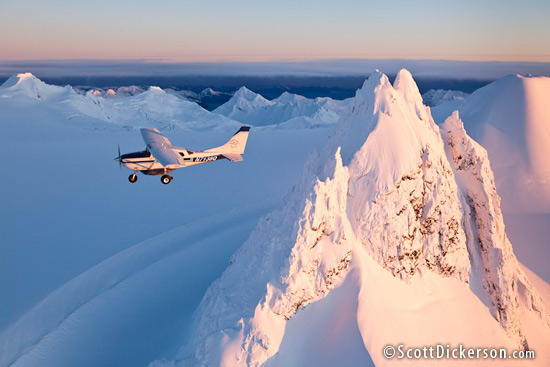
Air to Air aerial photo of a Homer Air Cessna 206 bushplane over the Kenai Mountains. When traveling in the ‘lower 48’ states one thing that has always surprised me is how the roads just seem to stop at nothing. Driving through the national parks especially I can hardly believe the places you can go without stepping out of the car – thinking especially of Glacier National Park and Yosemite. Those roads etched into the cliffs winding up and down the mountains. Arguably there are some impressive feats of road building in Alaska too. But for me, I’ll always try and find a way to glide past the peaks in the air before I beat my subaru up on some potholed gravel road through the mountains.
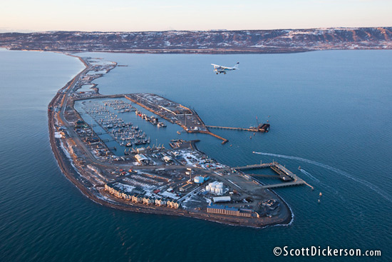
A bushplane flying past the end of the road in Homer, Alaska. -
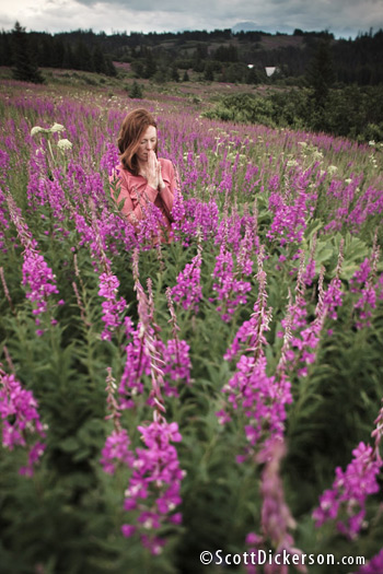
Fireweed meditation location scouting
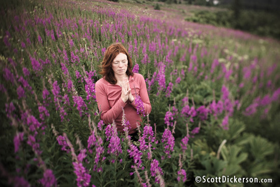
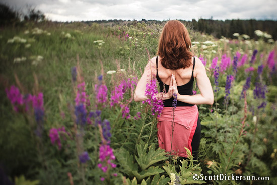
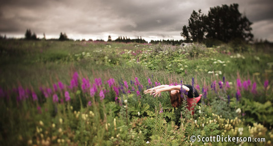
The fireweed in my front yard is half way done with its annual bloom. To an Alaskan that means summer is soon coming to a close. To an Alaskan photographer that means the fields are turning magenta and I only have so long to work with this amazing natural color event before it passes. The weather has not been so great for the last week, but I wanted to start scouting some locations to visit again when the light is right. Stephanie and I hiked up the local ‘homestead trail’ last night and played. I’m also practicing with a new lens I purchased last week – Canon TS-E 24mm. It’s a ’tilt-shift’ lens that does some funky depth of field tricks that many of you are probably familiar with. These shots are a continuation of my work connecting people with nature.
-
Exxon Valdez oil spill – 20 years later. More photos.
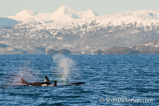
A couple weeks ago I posted a very brief note about a photo shoot I had just completed in Prince William Sound, Alaska documenting the crude oil that is still present on the beaches there. This was done on assignment for the World Wildlife Fund who is working to bring attention to the sad fact that 20 years after the oil was spilled, 19 years after the cleanup was ‘completed’, this toxic substance is still there, still contaminating this particularly beautiful environment.
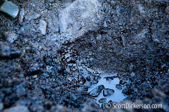
Twenty years is a long time.
I got to thinking about this.The place where we photographed and collected some of this oil was several feet below the high tide mark. Every twelve hours the ocean rises up to high tide and washes that beach, sometimes vigorously with wave and currents. I did a quick calculation – It’s been 20 years, 7,300 days, 14,600 high tides and the oil is still there just a few inches below the surface layer of rocks. This is truly amazing. It’s hard to comprehend the effects this oil must still be having on the environment in Prince William Sound as it slowly and constantly leeches out of the gravel into the water.
This sobering thought has changed the way I look at the oil industry that we collectively support. As long as we are buying oil in its myriad of products the tankers will keep transporting it. Shipping is safer now than it was in 1989, but by no means is it without risk. As we watch gas prices climb I hope that it will act as a reminder to us of the real cost of oil. What is paid at the pump is a drop in the ocean of the real costs associated with this industry, and we all bear it in many ways. Some sly ones such as health issues from pollution, others are obvious such as the devastation of the environment in such a precious place as Prince William Sound.
It’s clear that the oil industry is not good for us. What can one person do? I think we each need to answer this for ourselves. My approach is two fold: First I’m improving my awareness of consumption. What do I do that consumes oil or its byproducts? How do I minimize this consumption? Secondly, I am working on alternative energy sources to replace my oil consumption.
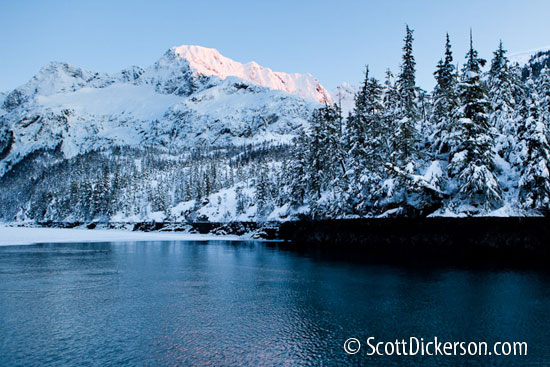
Below is an embedded slideshow of the 138 images from this trip that I’ve uploaded to the online photo archive. Mostly what you’ll see is a lot of beautiful scenery, mountains, glacier ice, whales, sea lions, sunsets and moon rises, then some documentation of the oily rock collection.
Special thanks to David Janka with the charter vessel ‘Auklet’ who made this trip not only possible, but also a very comfortable and productive three days in Prince William Sound. If you are looking for a boat to charter in Prince William Sound I can strongly recommend the Auklet with David as captain.

